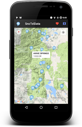
Features SnoTel Mapper
The SnoTel and SnoLite app is an ideal tool for backcountry skiers and anyone interested in snowfall and weather conditions across the United States.
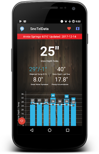
It maps the locations of over 700 SnoTel and SnoLite stations, which collect snow and climate data, providing timely information on observed temperature, precipitation, snow depth, and snow water equivalent for each station.
Additionally, the app displays graphs of snow depth and temperature, allowing users to analyze trends over time.
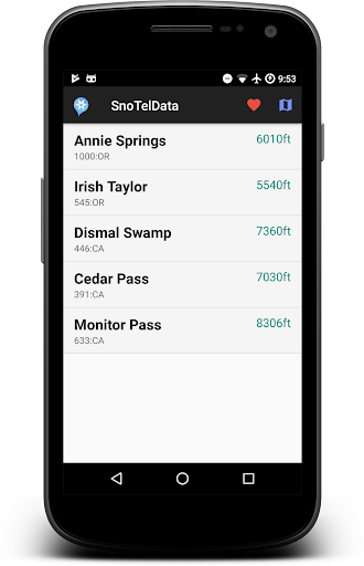
Users can save favorite stations.
The app also provides a beta avalanche danger level map to assess the risk of avalanches in different areas.
All data is sourced from the National Resource Conservation Service (NRCS), and historical data is also available.
The app is user-friendly, easy to navigate, and an essential tool for backcountry skiing and snow enthusiasts.New Releases are in TESTING >>> Please check out the Open BETA!
Help develop this app.
Gaming Features
Enjoy immersive gaming experience with various game modes.
Weather Features
Get accurate weather forecasts and real-time updates.
Food & Dining
Discover recipes and order food from your favorite restaurants.
See the SnoTel Mapper in Action
Get the App Today
Available for Android 8.0 and above